Walk No 4: Starting from Boldmere Gate
Suggested route about 1 mile (1 hour)
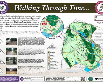
To download a copy of the route map - please click here or on the image of the map below
The road to Boldmere Gate (Stonehouse Road) runs alongside the large grassy dam of Powell’s Pool, which was built in 1730 and powered a watermill which made spades and later rolled steel. There were experiments in using water power to spin cotton here.
Walk straight ahead from the panel along the tarmac road to a junction of tarmac roads.
Marker no 4.1 is beside the road on the edge of the wood
The bank and ditch (woodbank) constructed around Holly Hurst in the 16th century to keep grazing animals out of coppiced wood. It was built on top of an earlier boundary, which had a ditch on the other side of it, and was a subdivision of the medieval deer park to create an enclosure into which deer were rounded up for hunting.
Turn right along the tarmac road into the wood.
Marker 4.2 is beside the road just inside the wood
The path to your right takes you to one of several sawpits where felled trees were cut. The group of conifers on the other side of the road are said to mark the centre of England and are surrounded by a bank which may have been built around an observation point in the medieval deer park. You may see the tower of Holy Trinity church in the distance along the road.
Continue through the wood, turn right along a tarmac road and continue downhill.
Marker 4.3 is beside the road at the top of the hollow way.
The hollow running alongside the road is a well-worn track which ran from the manor house along the dam of Wyndley Pool and across the Park to Streetly Gate.
Continue down the tarmac road and turn right along a path at the end of the hollow.
Marker 4.4 is near the bench, with a view of Wyndley Pool
Wyndley Pool ahead of you was a fish pond constructed in the 12th century. Sutton Coldfield manor house, where the Earls of Warwick lived when they hunted in Sutton Park in the Middle Ages, stood on the hill beyond the pool.
Continue along the tarmac road, turning left at a junction, back to the start of the route near Powells Pool.